Watershed management: how nature's engineering prevents floods
The integrated management of the water pathway from highland springs to urban river mouths is the ultimate barrier against flood tragedies
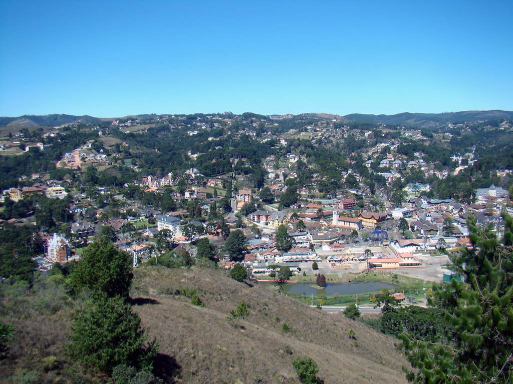
The devastating force of waters invading urban centers during storms does not begin on paved streets, but rather in the imbalances accumulated kilometers upstream, along the entire expanse that captures rain to feed rivers. Understanding the flood cycle requires looking beyond city walls and viewing geography in its entirety, where every hill, pasture, and riparian forest dictates the pace at which water descends into inhabited areas.
Anatomy of a watershed and water dynamics
A watershed is the entire land area that drains rainwater into a primary water body, such as a river, lake, or ocean. This system functions as a large geographical funnel bounded by watersheds divides, which generally correspond to the highest points of the relief, such as mountain ridges and hills. Everything that happens within this perimeter, from the construction of a road to the deforestation of a slope, directly impacts the quantity and speed at which water flows.
When a storm drops over a well-preserved basin, vegetation cover acts as the first defense mechanism. Tree canopies cushion the direct impact of raindrops against the soil, while the layer of fallen leaves and deep roots acts as a natural sponge. Much of this water slowly infiltrates the soil, recharging underground aquifers and feeding rivers gradually during dry months. Only the surplus that the soil cannot absorb turns into surface runoff, descending toward watercourses in a slow and measured manner.
Conversely, when the basin suffers from soil waterproofing and the removal of native vegetation, this balance collapses. Asphalt and concrete completely prevent water infiltration, forcing the entire volume of rain to run off instantly across the surface. Flow velocity increases sharply, turning streets into rapids and overloading urban rivers, which receive in a few minutes a volume of water that nature would take hours to direct.
Historical roots of channeling and the failed model
During the industrialization and population densification process that marked the 19th and much of the 20th century, the standard response to the urban flood problem consisted of hiding the water. Engineers and urban planners adopted the logic of rapid drainage, treating rivers as open-air sewage channels and enemies of urban development. Natural riverbeds were straightened, banks were concreted, and entire streams ended up buried under underground concrete galleries.
This approach was based on the principle that rainwater should be removed from urban areas as urgently as possible. High-speed gutters, rigid dikes, and containment walls were built to accelerate runoff toward oceans or larger rivers. However, time has shown that this strategy creates a disastrous cascading effect. By accelerating water in the lower part of the basin, the local river receives a concentrated and violent volume in record time, generating flood waves that overflow barriers and destroy bridges and homes.
With advances in hydrology and geosciences research, the scientific community and public planners recognized that trying to contain the force of water with reinforced concrete is a losing battle in the long run. The outdated model treated the symptom and ignored the cause, disregarding that the real problem lies in the upper and middle parts of the watershed. From the mid-20th century onward, the concept gained strength that flood control must occur at the source, slowing down runoff before water gains destructive volume and velocity.
Step-by-step natural engineering in flood control
Modern watershed management is grounded in interventions distributed throughout the entire territory, combining civil engineering techniques with ecological restoration. The first step of this process takes place in rural areas and river headwaters, where soil conservation practices are implemented. Farmers and landowners adopt techniques such as contour plowing, which halts the flow of rainwater down the hill, forcing it to penetrate the earth instead of running freely across the surface carving erosion furrows.
The second fundamental axis is the rigorous recovery of riparian forests and permanent preservation areas along watercourses. These strips of native vegetation not only filter sediments and pollutants that could silt up riverbeds, but also play an essential physical role. Tree roots structured along the banks function as a living armor that resists the erosive force of currents, preventing banks from collapsing and reducing the channel's discharge capacity.
In transition areas between the countryside and the city, management employs retention and detention basins. These are large depressions in the terrain, often transformed into public parks during dry periods, which function as hydrological lungs. When a severe storm discharges abnormal volumes of water, these temporary reservoirs accumulate excess runoff, releasing the liquid back into the river in a controlled and safe manner after the peak of the rain has passed.
Costs, volumes, and the monumental scale of the water cycle
The magnitude of the numbers involved in watershed management highlights the need for large-scale planning. A single medium-sized basin can span hundreds of thousands of hectares, encompassing dozens of municipalities and different biomes. In terms of volume, a moderate rain of a few hours over a deforested basin can precipitate billions of liters of water, a liquid mass whose weight is impossible to contain by any purely mechanical structure without causing structural collapses downstream.
Economic feasibility studies conducted by hydraulic engineering research institutions demonstrate that every monetary unit invested in watershed restoration and headwaters conservation yields dozens of times over in savings on emergency post-disaster reconstruction works. While the construction of containment walls and dikes requires constant maintenance and has a limited lifespan due to concrete fatigue, natural ecosystems tend to self-regenerate and increase their water-retention efficiency as vegetation matures.
Another impressive data refers to the infiltration capacity of managed soil. One hectare of soil covered by native forests or well-managed pastures can retain and infiltrate an expressively higher volume of rainwater than the same hectare of soil compacted by excessive cattle trampling or covered by asphalt paving. This capacity difference explains why cities cut through by degraded watersheds suffer recurrent floods even during moderate intensity precipitation.
Myths and misconceptions about flood control
The popular imagination and even public managers unfamiliar with the hydrological cycle often propagate simplistic solutions that worsen the problem rather than solve it. The most common misconception is believing that the deepening and periodic cleaning of urban riverbeds definitively resolves flood risk. Although the removal of accumulated sediment and garbage temporarily restores the channel's discharge capacity, this measure is useless if the basin remains waterproofed and deforested above the city. The river will quickly silt up again with the plowed earth from unprotected slopes.
Another widespread myth is the idea that building large dams in the lower parts of rivers eliminates the danger for riverside populations. While large reservoirs help regulate flows, they require complex operational control and generate severe socio-environmental impacts by flooding fertile valleys. Furthermore, if the watershed feeding the dam suffers widespread deforestation, the reservoir quickly loses capacity due to sediment accumulation, becoming ineffective against severe floods within a few decades.
There is also the false perception that basin management is an exclusively rural intervention. Water management requires incisive actions within the urban perimeter itself, such as requiring permeable pavements in parking lots, creating green roofs on buildings, and eliminating clandestine sewage connections that overload the drainage system. The city must relearn to absorb part of the water it receives, rather than transferring all runoff responsibility to channeled streams.
The direct impact of basin management on urban life
For the average citizen, the discussion about watersheds may seem distant, restricted to the offices of engineers and environmental scientists. However, the quality of this management is directly reflected in the daily lives and safety of those living in cities. When management is executed correctly, the frequency of traffic interruptions, the isolation of entire neighborhoods, and the destruction of public infrastructures such as sewage networks, paving, and public transit lines are drastically reduced.
Financial losses associated with urban floods affect the entire local economy, from the small merchant who loses inventory to the worker whose vehicle is destroyed by the force of water. Beyond measurable material damages, urban floods represent serious health risks. The mixture of rainwater with overflowing sewage spreads serious infectious diseases, such as leptospirosis and hepatitis A, primarily affecting vulnerable populations living along degraded rivers lacking riparian forests.
Valuing and preserving watersheds also means guaranteeing the security of potable water supply for urban centers. Rivers whose basins are protected by native vegetation exhibit lower turbidity and require less costly chemical processes at treatment plants. Thus, caring for the spring and soil at the top of the mountain directly translates into better quality water and more balanced bills for consumers at the end of the network.
Frequently asked questions about basin management and floods
Why does street asphalt cause floods if rain falls across the entire city? Asphalt and concrete are totally impermeable surfaces. In natural areas, water infiltrates the earth and slowly feeds underground aquifers. In the paved city, 100% of rainwater runs off instantaneously into streets and galleries, creating volumes that exceed the capacity of any drainage channel.
What is the exact function of trees in flood prevention? Trees fulfill a dual role: canopies cushion the mechanical impact of raindrops, reducing soil compaction, and deep roots create biological channels that facilitate deep water infiltration. On banks, roots hold the earth, preventing soil from collapsing and silting up riverbeds.
Why doesn't river cleaning done by city halls prevent floods on its own? Cleaning removes accumulated garbage and sediment, but does not alter the speed or volume of water arriving from the watershed. If surrounding soil remains deforested and impermeable, the river will overflow again at the first heavy rain, regardless of whether it is clean.
Can the average citizen participate in watershed management? Yes, through urban attitudes that reduce waterproofing in private lots, avoiding irregular trash disposal that clogs storm drains, maintaining green spaces in backyards, and demanding political authorities invest in nature-based infrastructure and integrated basic sanitation.
Water as an ally and the future of resilient cities
Harmonious coexistence between urban centers and watercourses depends on definitively overcoming the paradigm of combating nature. Watershed management demonstrates that flood security does not stem from higher walls or wider concrete channels, but rather from restoring the planet's capacity to absorb, filter, and direct water in a balanced way.
Integrating urban planning with environmental preservation is the only viable path to transform rivers that currently represent constant threats into landscape, ecological, and social value elements within cities. The future of urban water security demands that governments and civil society view the watershed as an interconnected living organism, whose well-being directly defines the survival and prosperity of communities inhabiting its bed.